


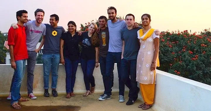
[Techie Tuesdays] Meet Arun Ganesh, the 29-year-old map man of India
![[Techie Tuesdays] Meet Arun Ganesh, the 29-year-old map man of India](https://images.yourstory.com/cs/wordpress/2017/03/ArunGanesh-Techie-Tuesdays.jpg?mode=crop&crop=faces&ar=2:1?width=3840&q=75)
At one point in time, almost all the over 30,000 Wikipedia articles related to India were using maps made by Arun Ganesh, a third-year student at SVCE, Chennai. From creating India’s first public transport map website and helping build a course on digital literacy at Homi Bhabha Centre for Science Education to now building maps full-time, Arun is a man on a mission.
When 29-year-old Arun Ganesh cycled to the office where he built maps with 21 colleagues every day, he had never imagined that his job (and interest) could be so helpful in the 2015 Chennai floods. Neither had he thought that he would get paid for something he had spent the past eight years doing purely out of interest. It has now been more than 10 years since Arun started working on maps. Having touched millions of lives and continuing to do so, this week’s Techie Tuesdays is dedicated to India’s map man.

The flight-simulated childhood
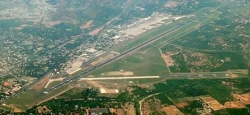
Arun was born in Dubai and moved to Abu Dhabi a few years later, where he did his schooling. His father, a mechanical engineer with the oil industry, has been working there since the 1980s. In his school days, Arun was a quiet and introverted kid. He got the computer quite early, in 1994, and it became an outlet of sorts, letting him do the things he couldn’t in real life. He played all the games which had maps — Microsoft Flight Simulator, SimCity, GTA, Age of Empires. He happened to read a lot of brochures and magazines on planes, aeronautics, airport construction and civil aviation, which developed his interest in aviation, planes, and travel.
Arun loved flying back to India for his summer vacations, simply because being in the air gave him a feeling of freedom and allowed him to see places from high above. He says,
“Unlike other kids my age who had a lot of interest in military planes, I had an interest in civil aircraft.”
Related read: Santosh Kumar – Script kiddie turned open source crusader
While playing Microsoft Flight Simulator, to make things more real, he started looking into the mechanics of how things work, like configuration and how the scenery was created. He wanted to make Abu Dhabi and Chennai airport in the flight simulator similar to the ones in real life, which was why he learned the software required to produce such models. Using 3D modelling (3DsMAX), he started creating add-ons for flight simulators, aircraft, and animations. He learnt Photoshop to use textures. He released a lot of his work online at that time. In the 10th grade, he was already a part of his first online community, the Flight Simulator Community, a forum where he gained popularity. At that time, not many people from India were active on these forums. Once, someone called him “plane mad,” which he thought was a good choice for a username. Soon, he started using it for all his handles.
“I was very clear that I wanted to be in the aviation world and in an airport. I knew being a pilot was hard. My interest was in being an air traffic controller, sitting in the control tower and looking at the data screen and controlling the planes.”
That was why he chose to pursue electronics and communications engineering from Sri Venkateswara College of Engineering in Chennai.
College, reality, and change of dream
Within the first few months of college, Arun realised that there was a massive difference between what he expected to learn and what he was actually taught.
Though he was staying in the hostel, he often went to the city to meet his sister, trips he would make by bus owing to a tight budget. This was when he realised how difficult bus travel could be without maps and information on bus stops and routes. Having seen how smoothly the public transport system outside India functioned, he was inspired to take up his first personal project — documenting Chennai’s bus system. He called it Chennai Bus Route mapping project(still available online).
He started taking random buses, carrying the city map on which he marked all the bus routes and stops. It was at this point that his waning interest in planes and rising fascination with buses and local trains (mapping) became evident. He learnt Adobe Illustrator to draw maps and make graphics. Inspired by the London metro map, he started working on a Chennai local train map. At that time, Wikipedia results were the top results for most of the searches (case remains the same even today), so Arun chose it to upload his work. He figured out how to edit a page and how to upload a photograph on Wikipedia. He could finally upload the map on the Chennai page on Wikipedia. He says,
“That felt like a big achievement because suddenly what I had made personally was available to the whole world. I got a comment on it the very next day which said that it was a beautiful map and asked if I was making it for other places as well.”
Next, he took up the task of making the road map of India, starting with the Golden Quadrilateral project. Arun collected data and some existing maps and created an outline map of India and put it online. He was making graphical maps of a quality which had never been seen online. At that time, all the maps of India were GIFs or made in paint. He was making the first SVG maps of India available online (uploading them on Wikipedia).
Also read the story of Santosh Rajan — the 56-year-old geek behind GeekSkool
Introduction to the world of open source
Arun spent most of his engineering days learning graphic software and involved with Wikipedia’s online communities. He also learnt about open source communities and was introduced to the concepts of open licensing, copyleft, and free software. He says,
I started feeling a part of a larger global community at that time where my role was to create maps, which no one else could do.
In 2007, because of their high quality, Arun’s maps set the standard for the colours that were to be used in maps on Wikipedia. The first cartography guidelines of how maps should look, what colours you should use, and how to show borders were all based on his maps. These maps were there in practically every Indian article page on Wikipedia. That's a set of ~200 maps which were visible in 30,000–40,000 pages on Wikipedia. Anyone who was perusing any of these articles was looking at Arun’s maps. He started uploading photos as well. While sitting in a library one day, he spotted one of his photos (of Ram Setu) on the cover of Frontline magazine. A lot of his photos were used in blogs and elsewhere because they were on Wikipedia. Although he wasn’t credited, his work started going places.
By this time, his dream of becoming an ATC was completely overshadowed by his interest in large open-source projects. He explains,
Making maps is a labour-intensive job. I have sat and drawn the outlines of 700 districts of India by tracing many government maps and realised that it's not scalable. When a new state is formed or when a district changes, you have to draw them again.
Arun knew that using graphic software to draw maps wasn’t the right way, and he soon stumbled upon OpenStreetMap, the Wikipedia of world maps which anybody can edit. When Arun zoomed in on India, it was a complete blank. There wasn't much documentation to explain what this project was and he wasn't sure how to draw roads or how it worked. He thought it was a European project and not meant for India.
A few months later, a couple of people from OpenStreetMap were in Bengaluru. Arun didn’t want to miss the opportunity and went to attend the OpenStreetMap event. He understood the philosophy of the project — to make an open source map of the whole world not controlled by any government or corporate. During the talk, he also understood how central maps are to our daily lives.
You may also like: How Chetan Ahuja is rewriting the 40-yr-old IP protocol to speed up your mobile apps
Mapping with OpenStreetMap
It was Arun’s third year of college. Still working on the Chennai bus map, he took his cycle and started collecting information on the names of streets, temples, shortcuts, and shops of interest, a process that made him feel more connected to the city. And when he compared Google Maps with his data, he realised that the former got many things wrong. He was keen on building a map based on the things he had seen while walking around because it would be something controlled by citizens and not by any corporate. It would have the things that are important to citizens.
Arun’s first project using OpenStreetMap was building Chennai’s bus route map. He didn't know how to code or build the website for the project. He says,
“But I had the idea and theoretically knew that people somehow have to share knowledge and crowdsource information like Wikipedia, but on a map. I wrote down everything and called it the Chennai Bus Route mapping project (this page is still available online).”
Arun started talking about this project idea at BarCamps, blogger meetups, and Tweetups. At one BarCamp, two people offered to help him. Within three days, one of the guys made a prototype website. On the website, there was a list of bus routes and bus stops (sourced from the government), and the interface would allow the user to click on the bus stop (text) and click on the map where that bus stop is located. After clicking on the map, the location of the bus stop is stored so that the next time someone opens the same route they see the location of the bus stop. The idea was to let anybody map the bus routes.
Within four days, over 90 percent of the 3,000 stops had been mapped, and for the first time ever, there were maps of all the bus routes in Chennai. Arun, along with two other student volunteers, (one in the first year and the other in the final year) built it in 2008, before Google Transit existed. It was the first Indian public transport map website and was built completely on open source.
He says,
It made me realise what amazing things can be done if there’s the motivation to do them. You don't need money or know how to build it yourself. You could just spread the idea, bring people together, and get it done. What the government and Google couldn't do, three people from college without any money did with open source tools, creating a resource for so many people.
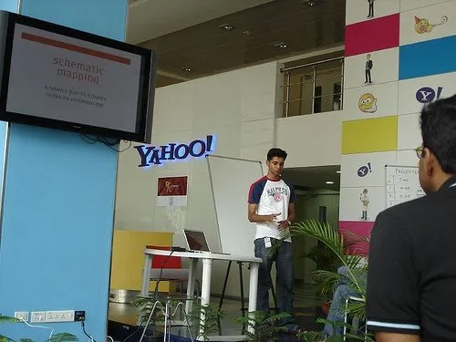
The website became popular and got over 2,00,000 hits per month. It also became a very good model to replicate for many open-source communities in other cities. A group of individuals got in touch with Arun and built ChaloBEST for BEST (Brihanmumbai Electric Supply & Transport) buses routes and stops. While his peers in engineering seemed stuck in the rut of classes and placements, Arun, because of his network and contribution to open source, would keep receiving offers from big companies like Yahoo! and Google. He says,
It was a huge boost of confidence for me and there was a very intense feeling in me that anything is possible. I knew that I wanted to remain in these open communities and wasn't interested in taking up traditional jobs. The payoffs of my work were much more than any monetary rewards.
Related read: From raising funds to shutting down to starting up again, this techie from a family of farmers has done it all
The formal design education
Arun didn't understand creative things. He was just doing things with the goal of sharing information on public transportation in India, and not with the interest to learn graphic design. But one of his college seniors told him that since his work revolved around designing maps it might be good for him to pursue a course in design, which was how he found himself at the National Institute of Design (NID), Bengaluru.
In his two years at NID, he could connect maps to many dimensions, physical worlds, human activities, and nature. He recalls, “A lot of the discussion in college was to identify our role in the society as designers.”
Arun’s final year project was at redBus, where he was chosen because of his work with busroutes.in (the Chennai project). He helped the company with improving the UI and travel experience. It was a conceptual idea of how the front page should look and how people should interact. The icons he made for the amenities of the bus (drinking water, blanket etc), still remain on the website.
From Wikipedia to the Wikimedia Foundation
In 2011, Arun attended the Wikipedia conference hackathon in Mumbai, where he met the chief designer of the Wikimedia Foundation. While discussing Wikipedia’s design challenges, he mentioned how one of the biggest problems it faced was allowing users to change the language. (Wikipedia was then supporting 250 languages.) For a person unfamiliar with English, the challenge would be to change the language (from English) from the dropdown where the languages were arranged in no particular order (because you can't order languages in any way).
Arun’s solution was to use maps, allowing people to select where they were from and pick from among the languages spoken there. The chief designer liked it and after a week, Arun received an email from the Wikimedia Foundation, asking him to join the team for this project. He spent eight months as a contractor with them on this project called the 'Universal Language Selector'. It is still available on all Wikipedia pages (on the top).
He was working as a designer and UI tester where he made prototypes in JAVA script to test it out with people across the world who don't speak English to check if this design works.
To the mountains
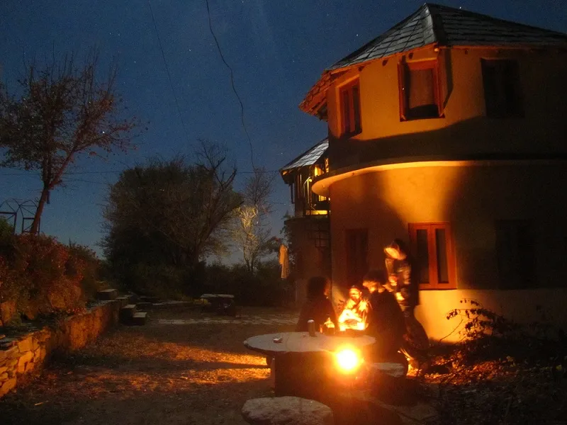
Towards the end of the contract, Arun’s found himself getting increasingly frustrated by city life. It was at the time he was struggling to make his life in Bengaluru more sustainable that he came across a story about a startup in Dharamsala which had a photo of a mud cottage. It was the YourStory.com article on Mindgrep, founded by Ayush Ghai. He got in touch with Ayush and expressed his interest in working from Dharamsala. Twenty-four hours of electricity and a broadband connection in the village had him convinced about moving there.
Arun spent his last month (December 2012) as a contractor with the Wikimedia Foundation in Rakkar, a small village near Dharamsala. He moved there permanently in May 2013. While in Rakkar, he attended many open community meetups in Pune, Hyderabad, and Mumbai.
The Government of India project
One day, he got called by professor G Nagarjuna at Homi Bhabha Centre for Science Education, TIFR, Mumbai, (because of his connections in open source and Wikipedia). The professor was looking for someone to join his team to build a course on digital literacy. It was a Government of India project aimed at introducing the computer to first- and second-year college students from 13 of the most backward areas and improving their skills for employability. He wanted Arun’s expertise in working with Wikipedia and OpenStreetMap to build the course module so that they could learn about Wikipedia and mapping. This includes how to research and write using Wikipedia and how to do mapping in OpenStreetMap. Since Arun was offered the flexibility to work from wherever he chose, he joined TIFR as a consultant.
This project exposed him to the functioning of the government and the education system. He went on field visits, built teacher training modules and course structures, and ran pilot programmes. His biggest challenge was to do all this in Hindi, a language he wasn't too familiar with.

Back to mapping
After the TIFR project, Arun was unsure of the direction he was heading in. At that time, he received an email that the Mapbox people were visiting Bengaluru and that he should meet them. He mentions,
“In 2008, when I started contributing to OpenStreetMap, I knew somewhere that citizen-created maps were going to be big even though they lagged behind Google Maps. I was hopeful that at some point, some company (maybe Google or any other) would start using crowdsourced maps. Mapbox was the first company which was doing it in a big way and I was following them for a while.”
He attended a meetup organised by Mapbox where they were mapping areas in Bengaluru. While mapping, they realised that everything was already well mapped by a user called planemad (which was Arun). He was later invited for dinner, where the CEO and a founding member of Mapbox shared their plans for India. He was approached to help build their team in India. He was happy to be employed doing what he had anyway been doing for the past seven years.
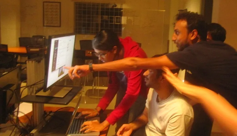
Arun’s first task at Mapbox was to build the mapping team, replicating his skills in a fresh team that had no previous experience of mapping. Mapbox India is now a team of 22 mappers who're all experts with the OpenStreetMap project. Unlike everyone else on the OpenStreetMap project (other experts who do it voluntarily), Mapbox employees are paid to do that with very high quality (of work) and skill. They work on data sets, which is very hard to do for a volunteer.
Also read: Meet the chief architect of Aadhaar, Pramod Varma
Tech behind maps
Arun says, “A lot of the tech behind the maps is humans. People are contributing local knowledge.” Basically, the tech is largely abstracted with huge geospatial databases which have a lot written and edited every single minute. In OpenStreetMap, more than 2,000 changes are made every single minute around the world which includes roads getting updates, deleted, information on public toilets, businesses, phone numbers.
What are mapping skills?
According to Arun, mapping requires a lot of mechanical skills. Identifying the roads, buildings, and rivers in a satellite image of the world correctly and to interpret the ground reality is a mapping skill which comes with experience. He says, “To be able to put yourself on the ground while being remote and to convert your thinking into a database model like how to model a road in terms of geometry and metadata is essentially the mapping skill.”
This is also how mapping software is built. The reality of maps is that there's some human being drawing shapes, and adding these properties to them. This is done by looking at multiple data sources, satellite images, other maps and photos from the ground. Altogether they create a map model.
Maps to the rescue during the Chennai flood
During the Chennai floods of 2015, Arun and his colleagues, within a few hours, built a simple, easy-to-use tool to mark which of the city's roads were flooded. There were no clear media reports regarding which parts of the city were flooded and what the scale of flooding was. They were able to pull in data from NASA and ISRO and put it all in one place, make it mobile-friendly, and build a backend to handle the huge load.
For the first couple of days nothing happened, but on the third day, when the floods started increasing, someone tweeted this map and people started marking flooded streets. One could zoom into the map and just highlight the road which was flooded, or deselect the highlight if the road was not flooded. The moment it was clicked, the data would be stored on the database and anybody else who loaded the map could see it. It started going viral and there were 200–300 people at any given point of time. Over the week, the tool got 1.2 million visits and collected over 15,000 street segments of flooding. It became a very important resource for people to plan out which roads to avoid and also for flood relief efforts to see which areas were most affected and how to aid victims.
What do maps teach us?
Through mapping over the years, Arun has learnt that the whole world is very tightly connected. It helps us understand the city, country, and the world and about the past, culture, and surroundings. He says,
Maps are the tools to solve (today's and) future problems. I get to see so many patterns which show the big picture of how things are connected. Maps as a medium is a very powerful cognitive tool.
Arun wants to use maps to empower every citizen to act more responsibly by exposing the world around them to them.
According to Arun, technology is applied science for a better future.
Arun takes inspiration from nature, which village life has given him plenty of access to. He believes that most of our problems have already been solved in nature. In addition, our history and culture also have a lot of answers.
You can follow Arun on Twitter.