

Aarav Unmanned Systems is mapping the future with its UAV technology


From being a figment of a science fiction writer’s imagination just a few years ago, today, unmanned aerial vehicles (UAVs) have become a reality. A handful of Indian startups are working on specialised UAVs that can be deployed for everything from disaster management and crop monitoring to land surveys and aerial photography.
Aarav Unmanned Systems (AUS), a YourStory Tech 30 company, is part of this select group of young startups building UAV technology in the country. Others include Drona Aviation, Edall Systems, AirPix, Skylark UAVs, and Eazypilot. Kanpur-based AUS provides faster and more cost-effective UAV-based land surveying solutions for the civil engineering and utility industries. The company is incubated at the SIDBI Innovation and Incubation Centre (SIIC) at IIT-Kanpur.
Starting up
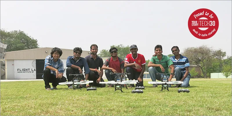
Co- founders — Nikhil Upadhye, Suhas Banshiwala and Vipul Singh — represented their college, IIT-Kanpur, at the Systems Engineering Awards competition organised by NASA in 2013. They had to design a UAV based on certain weight and payload specifications. The same year, the trio founded AUS.
While in the US for the competition, they noticed there was much more awareness about UAV technology there when compared to India, and realised how extensively UAVs were being used for recreational purposes.
Yeshwanth Reddy, 25, who joined the startup full-time as a Co-founder in 2014, says, “After a lot of brainstorming on possibilities versus fantasies, and a lot of technical scribbles, we were convinced that the utilisation of UAVs for engineering applications was the future of this technology. This was the point when we started working on building technology for 3D mapping and geographical information system surveying.”
A common interest in aero-modeling and robotics bonds the AUS team.
“The team is a perfect blend of skills required and are aligned with a common vision,” says Yeshwanth.
Nikhil, formerly a student-developer at the ‘Google Summer of Code’ programme, directs image processing, software development, controls and embedded systems at AUS. Suhas, who directs navigation, control systems and technology development, has been involved in robotics from his days as a student, and has previously worked with Flipkart as an analyst. Vipul joined IIT-Kanpur as a Research Associate in UAV development and directs systems engineering, sales, marketing and business development. Yeshwanth completed his M.Tech in Aerospace Engineering from IIT-Bombay after graduating from Amity University.
Vipul is the common thread that binds them all. He studied with Yeshwanth at Amity University and met Nikhil and Suhas when he began working as a Research Associate at IIT-Kanpur.
The product
Using photogrammetry, which is the use of photography to glean information like measurement and distances to generate accurate and detailed Digital Elevation Models or 3D representations of the terrain surface, can transform and change the way decisions are made in multiple sectors. This is where UAVs or UAVs will be useful.
Imagine having to construct a bridge in hilly terrain. The first step is to understand the region or topography. Usually, this is done using GPS mapping—a time-consuming and cumbersome process. The decision maker who requires the data is often not an engineer, but someone who relies on engineers to look at the data. UAV technology would not only allow this decision maker to have access to visuals of the topography, but the data collated by the UAV would allow him to have a 3D rendering of the topography, which would allow for better and more informed decision-making than ever before, all from the comfort of his office. This increases precision in decision-making and saves time.
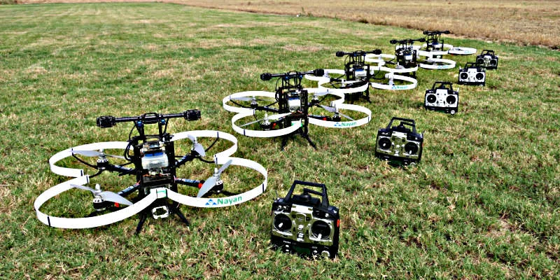
AUS has an all-in product called Nayan, which is a high-performance quadrotor for developers and researchers. However, Nayan is not AUS’s main product. GIS (Geographic Information System) mapping and precision agriculture are the main applications they are targeting. They have the prototype ready and the product will be out soon.
“Currently, these applications are served using land-based systems, which are slow, terrain-restricted, and not extensive. We just moved these things from land to air,” says Yeshwanth.
According to him, they are currently producing topographic data with an accuracy level of 50 to 60 mm, which is comparable to traditional GPS ground-based techniques. Yeshwanth claims their solutions are 15-20 times faster than the competition.
Revenue model
Started in 2013 with a seed capital of Rs 25 lakhs, AUS is in talks with potential investors to raise a pre-series A. The company declined to share its investors’ names. AUS has fewer than 10 customers and a revenue of less than Rs 1 crore.
Yeshwanth is clear that AUS does not want to simply be a UAV seller or service provider: “We want to be an end-to-end solution provider. This involves our product, our services and extensive analytical support in planning, maintaining, and developing our client’s infrastructure.”
The path ahead
They are currently planning a move to Bengaluru and to expand the team. Once the pre-Series A funds come through, AUS will work on more use-cases for its product and also work on more solutions.
“We want to make our UAVs more and more intelligent and venture out into unprecedented fields, which is the long-term vision of the company,” says Yeshwanth.
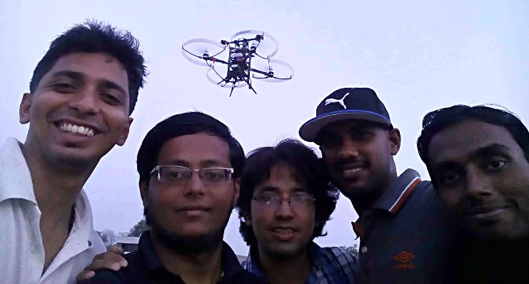
However, it is the excitement of working with a ‘cool’ technology and pushing its boundaries that fuels this team’s passion. “When we went near the India-Pakistan Line of Control and flew our UAV, when our first autonomous flight happened, and every time we see a new piece of our algorithm or code make the UAV fly and drop, we are seized with excitement,” Yeshwanth says with a smile.
Failures and learning
While brimming with excitement, confidence and passion, the team has not been immune to failure. That has come in different forms- from failure to deliver the first product to the client to loss of their prototype. However, with each failure, they have learnt important lessons:
- Never make promises on hope. Conduct as many verification tests as possible before making any commitments.
- Do destructive testing for worst-case situations for whatever you create. This always leads you to new milestones.
- When you are aiming for quality, never do ANYTHING in a hurry.
YourStory take
UAV technology is a high-potential new technology and AUS has entered this sector at the right time. There are multiple use-cases for UAVs, from recreation to defense, and the global market is expected to reach $5.5 billion, according to a MarketsandMarkets research report. However, the technology is evolving daily, and many companies, globally, are emerging in this category. Some of the giants in this sector include DJI, The Boeing Company, and General Atomics.
AUS has competition in India as well. The team will have to be on top of new UAV technology and start winning customers. They will need to keep an eye on government regulations that are also evolving as UAV usage becomes more popular. According to a Director General of Civil Aviation (DGCA ) notice issued to the public in October 2014, Unmanned Aerial Systems or UAVs have been branded a security threat. The notice says the operation of UAV will require approval from the Air Navigation service provider, Ministry of Defence, Ministry of Home Affairs, and other concerned security agencies, in addition to the DGCA. “The Ministry of Home Affairs poses a serious bottleneck to our operations and development. Currently we are having to take appropriate permissions every time we want to execute a project and with bureaucratic red tape it becomes a challenge,” says Yeshwanth.
If the AUS team is able to deal with these issues, the sky is the limit.
Website: http://aus.co.in/