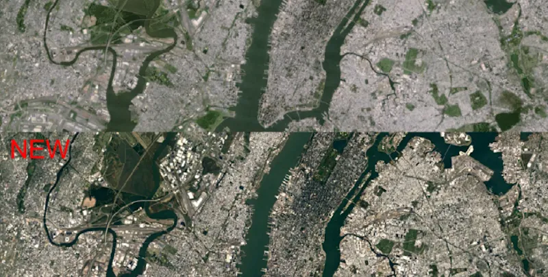
Google Maps just got sharper, and the difference is substantial!
Google is using new imagery from NASA’s Landsat 8 observation satellite in Google Maps and Google Earth, Program Manager Chris Herwig wrote in a blog on Monday. This will give sharper images when you use the “satellite” function on Google Maps. This function shows locations as they would appear in real life. The difference is substantial. Google offered two satellite images of New York City to display the change.

A report in The Huffington Post states that, getting such clear photographs involves a lot of data. “We mined data from nearly a petabyte of Landsat imagery—that’s more than 700 trillion individual pixels—to choose the best cloud-free pixels,” Chris wrote. “To put that in perspective, 700 trillion pixels is 7,000 times more pixels than the estimated number of stars in the Milky Way Galaxy, or 70 times more pixels than the estimated number of galaxies in the Universe.”
Landsat 8 (formerly the Landsat Data Continuity Mission, LDCM) was launched on 11 February, 2013. It has been collecting valuable data and imagery to be used in agriculture, education, business, science, and government. The Landsat Program provides repetitive acquisition of high resolution multispectral data of the Earth’s surface on a global basis. The data from Landsat spacecraft constitute the longest record of the Earth’s continental surfaces as seen from space.
Do you have an interesting story to share? Please write to us at tci@yourstory.com. To stay updated with more positive news, please connect with us on Facebook and Twitter.


