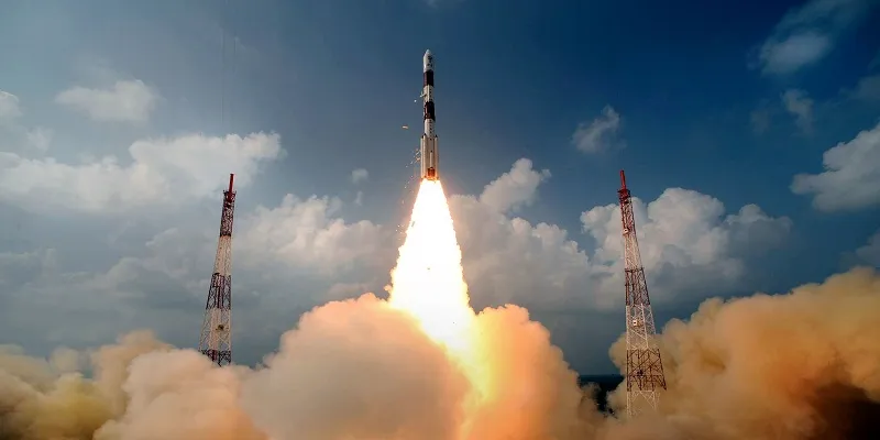
With Isro's final navigation satellite launch, India will soon have it's own GPS
Today, India completed its landmark mission for a regional navigational system at par with US-based GPS with the successful launch of IRNSS-1G, the seventh and last in the constellation of satellites that make up the system, reported The Economic Times. When the IRNSS-1G becomes operational in about a month’s time, the Indian Regional Navigation Satellite System (IRNSS) would offer services like terrestrial and marine navigation, disaster management, vehicle tracking and fleet management, navigation aide for hikers and travellers, visual and voice navigation for drivers.

Prime Minister Narendra Modi lauded the scientists and congratulated the people of the country on the achievement saying, “with this successful launch, we will determine our own paths powered by our technology”. “The world will know it as Navic…. The new technology will benefit our people, our fishermen. This is a great gift to people from scientists,” the PM said.
In a report by The Hindu, ISRO’s PSLV-C33, carrying India’s seventh navigation satellite IRNSS-1G, blasted off from the Satish Dhawan Space Centre in Sriharikota at 12.50 p.m.on Thursday. The satellite was successfully placed in sub-Geosynchronous Transfer Orbit. The countdown for the launch of the 1,425-kg satellite began at 9.20 a.m. on Tuesday. The integration of the rocket on the launch pad and the propellant filling operations were taken up at different stages during the 51.30-hour countdown.
A regional navigation satellite system with just seven spacecraft and in civil domain is unique to India. The three global versions of other countries offer worldwide commercial coverage and are operated by their militaries. IRNSS (Indian Regional Navigation Satellite System) will be to the subcontinent what the GPS is to its users worldwide, but with far greater precision and in Indian control, according to the Indian Space Research Organisation. It is expected to provide position accuracy of better than 20 m over Indian region and also an area extending up to 1,500 sq. km around India.
IRNSS will drive both everyday uses as a 24/7 standard service for air, sea, ship transport among others. It will also be used for military and missile-related applications as an encrypted and restricted service. Over the next three to six months, all the IRNSS satellites would be stabilised as a constellation, their signals and performance verified and later put to use, an ISRO official said. Two spare satellites are kept ready to be flown in an emergency. A full-fledged ground control centre in Bengaluru and tracking stations across the country have been put in place.
To stay updated with more positive news, please connect with us on Facebook and Twitter.
.


